Jet streams driving surge in western disturbances in northwest India| India News
North India’s Unseasonal Weather Surges March Western Disturbances
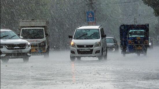
North India experienced an unusually active March, with eight Western Disturbances (WDs) compared to the normal five to six. This surge, driven by powerful jet streams, brought unseasonal rain, hailstorms, and temperature shifts across the region. At least three more are expected through mid-April, keeping meteorologists vigilant.
Western Disturbances are extratropical storms from the Mediterranean. They travel eastward, gathering moisture, and primarily affect northwest India in winter, providing crucial rain and snow for the Himalayas. While vital for crops and water, their increased frequency outside peak winter months is concerning.
Local reports confirm the impact: Punjab and Haryana saw significant crop damage from hailstorms. Uttarakhand’s higher reaches experienced late snowfall, while lower areas had consistent rain, affecting tourism and livelihoods. The India Meteorological Department (IMD) attributes this to an unusually strong, southerly jet stream, which funnels these systems more directly into the subcontinent.
This atmospheric anomaly disrupts agricultural cycles, especially for Rabi crops nearing harvest. It also poses challenges for infrastructure and public health due to abrupt weather changes. With three more WDs anticipated, unpredictable weather is set to continue into April. Residents and farmers should consult local advisories.
Key Takeaways:
- March recorded eight Western Disturbances, exceeding the norm.
- Strong jet streams are accelerating these systems into North India.
- Unseasonal weather has impacted agriculture and daily life regionally.
- Three additional disturbances are projected for mid-April.
- Staying informed via weather updates is essential for preparedness.
For timely weather insights and comprehensive reporting, rely on Omni 360 News.