Severe thunderstorm warning for Delhi-NCR, IMD red alert in some parts as skies turn grey
# NCR Weather: Red Alert in Meerut, Delhi Yellow
By Staff Correspondent, Metro Weather Desk, April 30, 2026
The India Meteorological Department (IMD) has issued critical weather warnings across the National Capital Region (NCR) on Thursday, April 30, 2026, as severe pre-monsoon thunderstorms threaten to disrupt daily life and infrastructure. The outer edges of the NCR, specifically Meerut in Uttar Pradesh, have been placed under a stringent ‘red alert’, signifying extreme weather conditions requiring immediate emergency action. Neighboring satellite cities Noida and Ghaziabad are under an ‘orange alert’, urging authorities and residents to be prepared for severe squalls. Meanwhile, the national capital, New Delhi, faces a ‘yellow warning’, advising citizens to stay continually updated. This abrupt and violent climatic shift is driven by severe convective cloud formations interacting with high pre-monsoon temperatures.
## Decoding the IMD Warnings Across the NCR
The color-coded alert system utilized by the IMD is a vital tool for disaster management, and the current spatial distribution of these alerts highlights the localized intensity of the incoming storm system. A **red alert**, currently active for Meerut and its surrounding rural belts, is the highest level of meteorological warning. It indicates a high probability of severe weather, including wind gusts exceeding 80 to 100 kilometers per hour, heavy localized rainfall, severe lightning strikes, and the potential for damaging hail. Under a red alert, local administrations are mobilized for immediate rescue and relief operations, as significant damage to fragile infrastructure, power lines, and temporary structures is highly likely.
Moving closer to the urban core of the NCR, Ghaziabad and Noida have been placed under an **orange alert**. This “be prepared” status warns of wind speeds ranging from 60 to 80 km/h. While slightly less severe than the conditions predicted for Meerut, an orange alert in densely populated and heavily trafficked urban centers like Noida translates to severe risks of urban waterlogging, traffic gridlocks, and localized power outages due to falling tree branches.
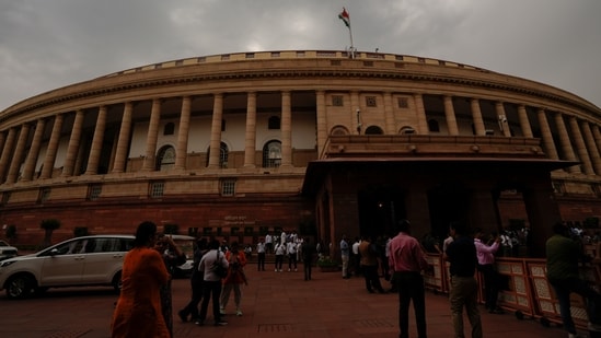
New Delhi is currently under a **yellow warning**, which translates to “be aware.” The capital is expected to experience widespread dust storms, moderate cloud cover, and gusty winds between 40 and 50 km/h. However, meteorologists caution that pre-monsoon storm cells can be highly dynamic, and a yellow warning can rapidly escalate if the storm system alters its trajectory. [Source: Hindustan Times | Additional: IMD National Weather Forecasting Centre, April 2026 Bulletins].
## The Meteorological Triggers Behind the Storm
Understanding the genesis of this severe weather event requires looking at the broader synoptic features over the Indian subcontinent. The late April period in North India is traditionally characterized by intense thermal heating. Over the past week, surface temperatures across the NCR have consistently hovered around the 40-42°C mark. This intense surface heating creates strong low-pressure areas that suck in moisture-laden winds.
According to atmospheric scientists, the current turbulence is the result of a deadly combination of weather systems. “We are witnessing the interaction of a western disturbance—a cyclonic storm originating in the Mediterranean region—moving across the western Himalayas, colliding with a moisture incursion from the Arabian Sea,” explains Dr. Rajendra Pathak, a senior synoptic meteorologist based in Pune.
“When this cool, moist air mass collides with the intensely heated, dry air over the Delhi-NCR and Western Uttar Pradesh plains, it triggers explosive convective activity. The result is the rapid formation of Cumulonimbus clouds, which can tower up to 15 kilometers into the atmosphere, bringing violent squalls, lightning, and hail,” Dr. Pathak added. This phenomenon, locally known as *Andhi* (dust storm) followed by thunderstorms, is a classic, albeit intensified, feature of the Indian pre-monsoon season.
## Ground Realities: Civic Preparedness and Economic Impact
The immediate implications of the IMD’s red alert in Meerut have forced rapid administrative mobilization. The District Magistrate’s office in Meerut has ordered the closure of all schools and educational institutions for the duration of the alert to ensure the safety of children. The National Disaster Response Force (NDRF) and local civil defense units have been placed on standby, particularly to respond to structural collapses or severe uprooting of trees along major thoroughfares.
Beyond urban infrastructure, the storm poses a catastrophic threat to the region’s agricultural economy. Western Uttar Pradesh is a major agrarian hub. While the bulk of the *Rabi* (winter) wheat crop has been harvested by late April, late-sown fields are at severe risk of lodging (falling over) due to high winds and hail. Furthermore, the region is famous for its mango orchards.
“Late April is a critical phase for the mango crop, as the fruit is currently in its early developmental stage following the flowering period,” notes Dr. Meena Srivastava, an agricultural economist. “A heavy hailstorm or cyclonic winds exceeding 80 km/h, as predicted by the red alert, could strip the trees of young fruit, potentially decimating the local mango yield for the 2026 season and causing massive financial losses to local farmers.” [Source: Original RSS | Additional: Uttar Pradesh Department of Agriculture 2026 Crop Status Reports].
## Impact on Aviation, Commuters, and Transit Networks
The cascading effects of the weather alerts are already being felt across the NCR’s extensive transportation networks. The Indira Gandhi International Airport (DEL) in New Delhi has issued preliminary advisories to passengers, warning of potential flight delays, holding patterns, and diversions. Standard aviation protocols dictate that operations are suspended if crosswinds exceed safe thresholds or if severe lightning is detected within the airport’s immediate vicinity. Passengers traveling with Air India, IndiGo, and other major carriers have been urged to verify their flight status before heading to the airport.
On the ground, commuter transit faces equally daunting challenges. The Delhi Metro Rail Corporation (DMRC) has protocols in place to reduce the speed of trains running on elevated corridors when wind speeds exceed 40 km/h, a threshold expected to be breached under the yellow and orange alerts.
The RapidX (Namo Bharat) Regional Rapid Transit System (RRTS), which connects Delhi to Meerut, is under particular scrutiny. Given the red alert in Meerut, authorities are monitoring cross-wind sensors along the elevated viaducts. Speed restrictions or temporary suspensions of service on the operational stretches of the RRTS may be implemented to guarantee passenger safety.
Similarly, highway police have issued advisories for the Delhi-Meerut Expressway (NH-9) and the Yamuna Expressway. Sudden pre-monsoon dust storms are notorious for dropping highway visibility to zero within seconds, leading to deadly multi-vehicle pile-ups. Commuters are advised to pull over safely with hazard lights on if caught in a sudden dust squall.
## Climate Context: The Rising Frequency of Extreme Weather
While pre-monsoon thunderstorms are a historical norm in Northern India, the intensity, frequency, and spatial spread of these events have undergone a perceptible shift over the last decade. Climate analysts point to global warming as a significant threat multiplier that is supercharging these storm systems.
**Key climatic shifts observed in recent years include:**
* **Intensified Thermal Gradients:** Higher baseline temperatures in April create more immense convective energy, leading to stronger updrafts and more violent storms.
* **Moisture Volatility:** Warmer seas (both the Arabian Sea and the Bay of Bengal) increase the moisture-holding capacity of the atmosphere, dumping heavier, more concentrated rainfall during these brief storm windows.
* **Erratic Western Disturbances:** The tracks of western disturbances have become more unpredictable, often dipping further south than usual and colliding violently with pre-monsoon heatwaves.
“What we are observing in 2026 aligns with the projections set forth in recent intergovernmental climate reports,” states Dr. Aarav Sengupta, an independent climate researcher. “The transition from spring to summer in North India is no longer gradual. It is characterized by whiplash weather—prolonged, intense heatwaves violently interrupted by severe, destructive squalls. The red alert in Meerut is a microcosm of this escalating climatic volatility.” [Source: Hindustan Times | Additional: Global Climate Impact Assessments, 2025-2026].
## Critical Advisories for Residents
In light of the IMD’s tiered warnings across the NCR, disaster management authorities have issued comprehensive safety guidelines for residents to minimize the risk of injury and property damage over the next 24 to 48 hours:
1. **Stay Indoors:** Avoid unnecessary travel during the late afternoon and evening hours, which is the peak time for convective storm development.
2. **Avoid Vulnerable Structures:** Do not seek shelter under isolated trees, temporary tin sheds, or large metal hoardings, which are highly susceptible to uprooting and lightning strikes.
3. **Electrical Safety:** Unplug sensitive electronic appliances to protect against power surges caused by lightning. In the event of a power outage, rely on battery-operated flashlights rather than candles to reduce fire risks.
4. **Secure Loose Objects:** Residents in high-rise apartments in Noida, Ghaziabad, and Delhi should secure potted plants, outdoor furniture, and loose materials on balconies to prevent them from becoming deadly projectiles in high winds.
5. **Stay Informed:** Continuously monitor local news broadcasts and official IMD social media channels for real-time updates and radar imagery.
## Conclusion and Future Outlook
The IMD’s issuance of a red alert for Meerut, an orange alert for Noida and Ghaziabad, and a yellow warning for Delhi serves as a stark reminder of the immense power of pre-monsoon weather dynamics in Northern India. As April 2026 draws to a close, the NCR finds itself navigating the perilous intersection of extreme heat and violent storms.
While local administrations and disaster response forces are better equipped today with real-time radar data and rapid communication channels, the ultimate safety of the populace relies on public vigilance and adherence to official advisories. Looking ahead, city planners, agricultural policymakers, and infrastructure developers must increasingly factor this “whiplash weather” into their long-term resilience strategies, as the climate of the National Capital Region continues to evolve into a more volatile paradigm. Citizens are urged to remain cautious, prioritize safety over transit, and weather the storm responsibly.