All eyes to the sky: Pvt startup pushes limits in space tech race| India News
# GalaxEye Merges SAR & AI in Space Tech
By Science Desk, TechSpace Insider, April 13, 2026
**Bengaluru, India** — GalaxEye, an innovative private space technology startup, is fundamentally disrupting the global earth observation market by engineering a satellite that combines optical imaging and Synthetic Aperture Radar (SAR) with an onboard Artificial Intelligence processing layer. Announced this week, this breakthrough promises to deliver seamlessly readable, all-weather earth observation data to any commercial client, bypassing traditional analytical bottlenecks. As the global space race pivots from government monopolies to agile private enterprises, GalaxEye’s approach answers the critical demand for real-time, actionable orbital intelligence regardless of atmospheric conditions. [Source: Hindustan Times | Additional: Industry SpaceTech Trends]
## The Dawn of Multi-Sensor Orbital Platforms
For decades, the Earth Observation (EO) industry has operated on a bifurcated model. Clients needing high-resolution, color-accurate imagery relied on optical satellites. However, optical sensors suffer from a glaring vulnerability: they are entirely useless when their view is obstructed by clouds, smoke, or darkness. Given that roughly 67% of the Earth’s surface is covered by clouds at any given moment, the reliability of optical data is fundamentally compromised.
Conversely, Synthetic Aperture Radar (SAR) satellites solve the weather problem. By actively emitting microwave pulses and measuring the backscatter, SAR sensors can penetrate dense cloud cover, torrential rain, and absolute darkness. Yet, raw SAR data is notoriously complex. It produces grainy, black-and-white, highly technical readouts that require specialized radar analysts to interpret. To the untrained eye, or a commercial client looking for quick answers, SAR imagery resembles television static.
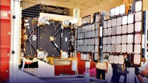
**GalaxEye’s breakthrough lies in the fusion of these two distinct technologies.** By housing both optical and SAR payloads on a single, compact orbital bus, the startup ensures that the same geographical coordinates are imaged simultaneously across both spectrums.
“The historical bottleneck in satellite imagery hasn’t just been capturing the data, but making it immediately useful,” notes Dr. Arindam Bose, an independent aerospace analyst based in New Delhi. “By overlaying multispectral optical data with radar topography in real-time, GalaxEye is effectively creating an ‘all-weather, all-seeing’ capability that was previously the exclusive domain of highly classified, multi-billion-dollar military constellations.” [Source: Hindustan Times | Additional: Expert Aerospace Analysis]
## Edge AI: Transforming Raw Data into Instant Insights
Merging two massive data streams on a satellite traveling at 7.8 kilometers per second presents a monumental telemetry challenge. Traditional EO satellites downlink raw data to ground stations, a process that consumes massive amounts of bandwidth and time. The raw data is then processed in terrestrial server farms before being handed over to the end-user—a cycle that can take days.
GalaxEye intends to shatter this latency by introducing a sophisticated layer of **Edge Artificial Intelligence (Edge AI)** directly into the satellite’s onboard computer.
Instead of beaming gigabytes of raw optical and SAR data back to Earth, the onboard AI acts as an automated analyst. It takes the clear structural data from the SAR sensor, colorizes and contextualizes it using the optical data (or historical optical data if the target is currently clouded), and generates a clean, readable, actionable image.
“What GalaxEye is proposing is a fundamental paradigm shift from ‘Data-as-a-Service’ to ‘Insights-as-a-Service’,” explains Dr. Elena Rostova, a prominent researcher in orbital edge computing. “If an agricultural client wants to know the soil moisture of their crops, they don’t want a raw radar file. They want a clear, mapped image highlighting dry areas. GalaxEye’s AI layer does this interpretation in orbit, downlinking only the lightweight, finalized insight. This drastically reduces bandwidth costs and delivery times.”
## Democratizing Earth Observation for Global Markets
The implications of accessible, weather-independent satellite data are vast. The global Earth Observation market is projected to surpass $14 billion by the end of the decade, driven by surging demand from non-traditional sectors. GalaxEye’s client-agnostic model is designed to cater to an array of industries that previously found satellite tasking too expensive or complex.
**Key sectors poised for transformation include:**
* **Agriculture & Food Security:** Crop yields are highly dependent on soil moisture and structural integrity, which SAR detects perfectly. GalaxEye’s fused data allows farmers to see crop health through monsoon clouds, enabling precise irrigation and fertilizer application.
* **Disaster Management:** During floods or hurricanes, optical satellites are blinded by storm clouds. GalaxEye can provide immediate, readable damage assessments to first responders, accurately mapping flood extents over city infrastructure.
* **Maritime & Supply Chain:** Tracking illegal fishing vessels (which turn off their transponders) or monitoring congested shipping ports becomes effortless, regardless of marine fog or nighttime conditions.
* **Insurance & Climate Risk:** Insurers can verify property damage from natural disasters within hours rather than weeks, accelerating claim payouts and risk assessment.
### Comparison: Traditional vs. GalaxEye EO Models
| Feature | Traditional Optical Satellites | Traditional SAR Satellites | GalaxEye Fused AI Model |
| :— | :— | :— | :— |
| **Cloud Penetration** | No | Yes | **Yes** |
| **Output Readability** | High (Visual) | Low (Technical) | **High (AI-Translated)** |
| **Data Processing** | Ground-based (Days) | Ground-based (Days) | **On-Orbit Edge AI (Hours)** |
| **Bandwidth Cost** | High | High | **Low (Actionable Insights)** |
| **Weather Dependency**| High | None | **None** |
[Source: Hindustan Times | Additional: Earth Observation Market Data]
## India’s Commercial Space Race Heats Up
GalaxEye’s ambitious roadmap is a direct product of India’s rapidly maturing private space sector. Incubated at the prestigious Indian Institute of Technology (IIT) Madras, the startup is capitalizing on the sweeping privatization policies introduced by the Indian government under the IN-SPACe (Indian National Space Promotion and Authorization Centre) initiative.
Prior to these reforms, the Indian Space Research Organisation (ISRO) held a strict monopoly on space activities. Today, a vibrant ecosystem of private launch providers (like Skyroot Aerospace and Agnikul Cosmos) and satellite manufacturers are pushing the boundaries of what is possible in Low Earth Orbit (LEO).
“The innovation we are seeing from Indian space startups is no longer about catching up to the West; it’s about leapfrogging,” states an April 2026 report by the SpaceTech Policy Institute. “Companies like GalaxEye are not just launching legacy hardware; they are integrating modern software philosophies—like AI and edge computing—into spaceframe architecture from day one.”
By offering a unique, globally competitive product, GalaxEye is positioning India not just as a hub for cheap satellite launches, but as a premier destination for high-end orbital data analytics.
## Technical Challenges and Orbital Realities
Despite the immense promise, GalaxEye’s path to a fully operational, multi-sensor constellation is fraught with engineering hurdles. The primary obstacle is the stringent **SWaP constraint**—Size, Weight, and Power.
SAR systems are incredibly power-hungry because they must physically generate and broadcast microwave radiation down to Earth. Traditional SAR satellites require massive solar panels and heavy batteries. Conversely, optical systems require highly stable, vibration-free platforms to capture crisp images. Housing both systems on a commercially viable, smaller satellite frame requires unprecedented miniaturization and power-sharing algorithms.
Furthermore, running AI processors in space presents severe thermal management issues. In the vacuum of space, dissipating the heat generated by high-performance GPU chips is incredibly difficult. GalaxEye’s engineering teams have reportedly developed proprietary thermal regulation systems and radiation-hardened computing modules to ensure their AI layer can survive the harsh environment of Low Earth Orbit without burning out or experiencing logic errors induced by cosmic radiation.
## Conclusion: A Clearer View of Tomorrow
As GalaxEye moves closer to full commercial deployment, the startup is setting a new benchmark in the global space technology race. By successfully marrying the visual clarity of optical data with the all-weather reliability of SAR, and packaging it within an automated AI framework, they are effectively stripping away the complexity of Earth Observation.
The ultimate promise of GalaxEye is democratization. When actionable satellite data becomes as accessible and easy to read as a weather app on a smartphone, the potential for global problem-solving expands exponentially. From optimizing global supply chains to fighting the immediate impacts of climate change, having clear, continuous eyes in the sky will no longer be a luxury—it will be a standard tool for the modern world.