Digitally map forest limits: Govt to states| India News
# Govt Orders Digital Mapping of Forest Limits
**By Vikram Aditya, National Policy Desk | April 15, 2026**
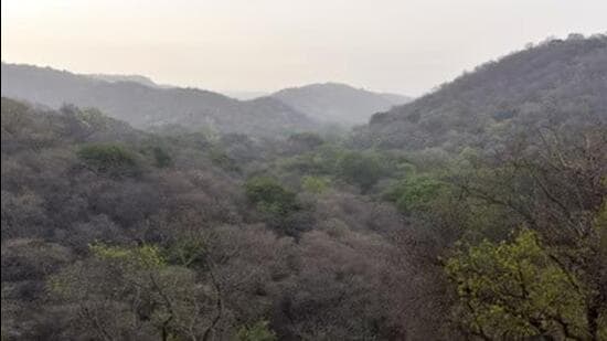
In a decisive move to curb ecological degradation and streamline regulatory approvals, the Union Government mandated all state governments on Wednesday to comprehensively digitally map and demarcate their respective forest limits. Rooted in the ongoing compliance requirements of the landmark *Lafarge Umiam Mining Pvt. Ltd. vs. Union of India* case—which dealt with controversial environmental clearances for limestone mining in Meghalaya—the new directive establishes a strict framework for modernizing India’s environmental records. By leveraging advanced geospatial technologies, the Centre aims to eliminate the administrative ambiguities that have historically fueled illegal encroachment, unregulated deforestation, and prolonged legal disputes over land-use classification. [Source: Hindustan Times | Additional: Ministry of Environment, Forest and Climate Change Guidelines 2026]
## The Lafarge Precedent: A Catalyst for Change
To understand the urgency of Wednesday’s directive, one must look back at the judicial legacy of the *Lafarge Umiam Mining* case. The Supreme Court of India was forced to intervene when it was discovered that extensive limestone mining was taking place in the pristine, dense forests of the East Khasi Hills in Meghalaya. The project had originally received environmental clearances because local authorities and state agencies had erroneously—or deceptively—classified the ecologically sensitive area as non-forest wasteland.
The ensuing legal battle exposed glaring loopholes in how forest land was identified and cleared for industrial use. The Supreme Court’s comprehensive judgment laid down sweeping guidelines to reform the environmental and forest clearance process. It mandated the creation of robust, transparent mechanisms to ensure that high-value ecological zones were not sacrificed for industrial extraction under the guise of bureaucratic “clerical errors.”
“The Lafarge case was a watershed moment in Indian environmental jurisprudence,” explains Dr. Meera Sanyal, a senior fellow at the Institute for Environmental Law and Policy. “It highlighted the disastrous consequences of relying on outdated, analog revenue records. The Centre’s latest push for digital mapping is effectively the final, much-delayed technological execution of the principles established in that courtroom.” [Source: Supreme Court of India Archives]
## Transitioning from Analog Paper to Digital Precision
For decades, forest demarcation in India has relied on colonial-era cadastral maps, physical boundary pillars, and fragmented revenue department records. These documents are frequently prone to degradation, manipulation, and misinterpretation.
Under the new mandate, states are required to utilize **Geographical Information Systems (GIS)**, high-resolution satellite imagery, Differential Global Positioning Systems (DGPS), and LiDAR (Light Detection and Ranging) drone surveys to create immutable, three-dimensional maps of forest boundaries.
The Union Government has instructed that these digital boundaries must be cross-referenced and integrated into the **PARIVESH 2.0 portal**—the national single-window system for environment, forest, wildlife, and Coastal Regulation Zone (CRZ) clearances. By establishing a central repository of digitized forest limits, project proponents, environmental watchdogs, and government agencies will have access to the same baseline data, fundamentally transforming the initial stages of project planning and clearance applications.
## Implications for the Forest (Conservation) Act
The timing of this directive is highly significant, arriving in the wake of the polarizing Forest (Conservation) Amendment Act of 2023. The 2023 amendments controversially stipulated that the Act’s protections would primarily apply to land officially notified as a forest under the Indian Forest Act, 1927, or land recorded as a forest in government records on or after October 25, 1980.
Critics argued that this definition left massive tracts of “unclassed” or “deemed” forests—areas that look like forests ecologically but lack official paperwork—vulnerable to commercial exploitation.
The April 2026 directive to digitally map forest limits forces state governments to definitively identify and record these unclassed forests. “This is a double-edged sword,” notes Rajesh Menon, a geospatial analyst specializing in land use. “If state governments conduct these digital surveys accurately and comprehensively, millions of hectares of fragile ecosystems will be permanently shielded in digital databases. However, if states rush the process or intentionally exclude contested areas to favor real estate or mining lobbies, those ecosystems will be digitally erased from protection.” [Source: Additional Knowledge / Public Policy Analysis]
## State-Level Challenges: Capacity and Coordination
While the directive is clear, the execution at the state level is poised to be immensely challenging. Ground-level forest demarcation requires unprecedented coordination between state Forest Departments and state Revenue Departments, two entities that historically operate in silos and frequently possess conflicting land records.
Furthermore, many state governments lack the financial bandwidth and technical expertise required to execute large-scale LiDAR and DGPS mapping. The rough terrain in states like Arunachal Pradesh, Uttarakhand, and Meghalaya—where the Lafarge controversy originally erupted—makes physical ground-truthing of satellite data difficult and expensive.
The Union Ministry has reportedly assured states of technical assistance through the Forest Survey of India (FSI) and the National Remote Sensing Centre (NRSC), alongside a dedicated allocation of funds through the Compensatory Afforestation Fund Management and Planning Authority (CAMPA). However, state officials have privately expressed concerns over the tight deadlines associated with the mandate, fearing that rushed surveys could lead to massive litigation.
## Balancing Industry Certainty and Conservation
From a macroeconomic perspective, the business community has largely welcomed the directive. Industries such as mining, infrastructure development, and renewable energy have long cited the lack of clear forest boundaries as a major hurdle to the ease of doing business in India.
Currently, a corporation might invest heavily in a mining block, only to have operations halted mid-way by the National Green Tribunal (NGT) because local activists proved the land overlapped with an unrecorded forest.
“Predictability is the bedrock of industrial growth,” says an executive from the Federation of Indian Mineral Industries (FIMI). “A definitive, legally binding digital map of forest limits removes the gray area. If an area is marked red on the digital grid, we won’t bid for it. If it is clear, we can proceed with the assurance that we won’t face post-clearance litigation based on boundary disputes.”
Simultaneously, conservationists emphasize that this certainty cannot come at the cost of nature. The digital mapping exercise must incorporate strict ecological parameters, ensuring that vital wildlife corridors and eco-sensitive zones are mapped with high fidelity.
## The Forest Rights Act (FRA) Conundrum
A critical factor in the digital mapping process will be the integration of the **Scheduled Tribes and Other Traditional Forest Dwellers (Recognition of Forest Rights) Act, 2006 (FRA)**. Traditional forest-dwelling communities have historical claims to forest lands that are often not reflected in satellite imagery or official government records.
Tribal rights advocates are urging the government to ensure that digital demarcation is not conducted in a top-down vacuum. Ground-truthing must involve Gram Sabhas (village councils) to ensure that community forest rights and traditional boundaries are accurately digitized and respected. Ignoring this human element in favor of cold satellite data could trigger widespread social unrest in the tribal belts of Central and Northeast India.
## Conclusion and Future Outlook
The Union Government’s directive to digitally map forest limits represents a necessary evolution in India’s environmental governance. The lessons learned from the Lafarge Umiam Mining case in Meghalaya highlight that environmental clearances cannot be granted on the foundation of ambiguous, easily manipulated paper records.
As India races toward its ambitious economic goals and its international climate commitments—including the creation of an additional carbon sink of 2.5 to 3 billion tonnes of CO2 equivalent by 2030—knowing exactly where its forests begin and end is not just a legal requirement; it is an ecological imperative.
The success of this mandate will ultimately hinge on cooperative federalism. If states embrace the technological challenge transparently, India could soon boast one of the world’s most sophisticated and accessible forest governance databases. However, if the process gets bogged down in inter-departmental friction or political maneuvering, the digital maps will merely become high-tech mirrors reflecting the same old administrative flaws.